Online data of River Nene monitoring station – Upsteam at Flore Mill – October 2020

Flood Watch

A reminder of the on-line access to real time data for rainfall and river levels and flood map risk planning websites relevant to Nether Heyford.

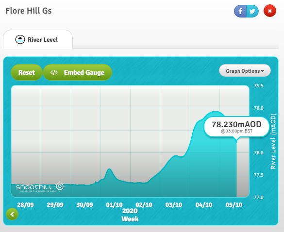
Latest recorded levels of the river Nene can be found on the Shoothill GaugeMap website.

Upstream at Flore:

RiverNeneUpstreamLevel05102020

RiverNeneUpstreamLevel05102020_year

Link: https://www.gaugemap.co.uk/?fbclid=IwAR2DdUovxyz69PkLN7mCTLdQ3ZcsJtAtooMzN-y2MP6wb53J2aXp9O99mU0#!Map/Summary/11644/7051

Downstream at Bugbrooke:

ShoothillGaugeMap-Bugbrooke

(B) River and sea levels  Flood information service for England from Gov.uk

(C) Northamptonshire County Council: www.floodtoolkit.com

NetherHeyfordFloodPlanningMap-June2020

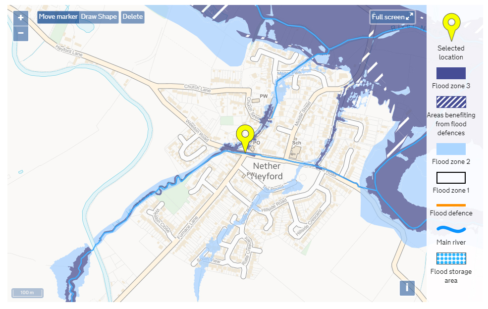
GOV.UK Check your long term flood risk | GOV.UK Flood map for PlanningNether Heyford: Flood map for planning

Re-Published from earlier Flood Watch articles in 2020 from J.Arnold

Leave a Reply

Fill in your details below or click an icon to log in:

WordPress.com Logo

You are commenting using your WordPress.com account. Log Out /  Change )

Twitter picture

You are commenting using your Twitter account. Log Out /  Change )

Facebook photo

You are commenting using your Facebook account. Log Out /  Change )

Connecting to %s